VT SuperDARN
Login
Register
News
VT
VT Technology
SuperDARN
Student Opportunities
Links
Space Weather Portal
Calendar
VT Home
VT ECE Home
Space@VT
SD Pub List
SWF Monitor
Suggestion Box
Contacts
Personnel
Contact/Visit US
Quick Browse
Daily Multi-Radar Plots
Range-Time Plots
Convection Maps
Daily GeoActivity Plots
Interactive Plots
RTI
Fan
Map
Radars
Radar Pages
Radar Hardware
Realtime Data
Data Acknowledgements
Register/Login
Register
Login
SuperDARN Resources
Quick Start Guide
.word-wrap{word-wrap: break-word;}
Wallops Island
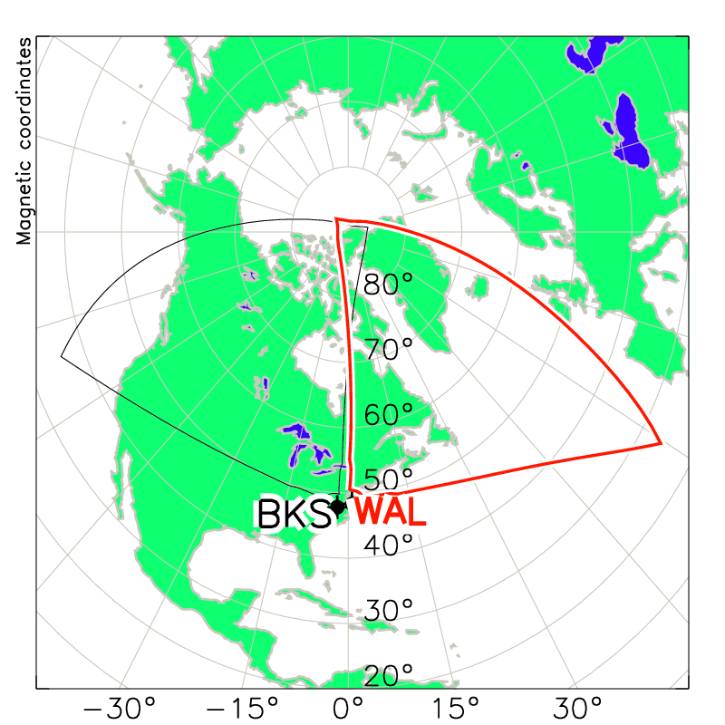
WALLOPS ISLAND, VA (37.93 N, -75.47 E) The SuperDARN radar at Wallops Island was the first to be constructed using the Twin-Terminated-Folded-Dipole (TTFD) antenna design. This design is lighter and cheaper than the original log-periodic design with better backlobe characteristics because of the addition of a reflecting screen. The radar saw first light in June 2005. The radar is located on the grounds of the NASA Wallops Flight Facility (WFF). It was built and is operated as a joint project of the Johns Hopkins University Applied Physics Laboratory (JHU/APL) supported by NSF and NASA/GSFC. The original PI was Dr. Ray Greenwald. The PI-ship has since passed through Mike Ruohoniemi, Elsayed Talaat, and Ethan Miller to the current PI, Alex Chartier. Alex assumed the PI-ship on 6 September 2019. Notes: The physical boresite of the radar, i.e. the direction normal to the antenna array, is 35.86 degree relative to geographic North. In 2006, the scanning boresite, i.e. the direction of the middle beam, was changed to 26.14 degree in order to close the gap between the fields-of-view of the Wallops and the Blackstone radar. Later in 2006 the scanning boresite was again changed to match the physical boresite, however, four extra beams were added symmetrically around the boresite in order to close the gap between the fields-of-view.
Download Wallops Island Hardware File